Home · Credits
Credits
Credits
Photographs and radar views come from NASA / JPL (and, for one hemispheric mosaic, USGS). They are in the public domain and may be used in paid printables. Several Magellan frames are radar-derived or computer-generated perspectives, not optical photographs of the ground; each caption says so.
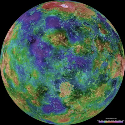
PIA00157.jpg — NASA / JPL / USGS, Public Domain (NASA).
A hemispheric radar view of Venus, centred at 0° east longitude, from more than a decade of radar work culminating in NASA’s Magellan mission of 1990–1994. This is a radar mosaic, not a visible-light photograph of the surface. NASA / JPL / USGS. Public domain. Photojournal PIA00157. May be used in paid printables (public domain).
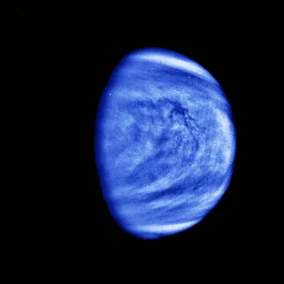
PIA00072.jpg — NASA / JPL, Public Domain (NASA).
Cloud patterns on Venus, photographed by the Galileo spacecraft’s Solid State Imaging System on 14 February 1990, from almost 1.7 million miles (about 2.7 million kilometres). The published frame is colourised and filtered; it shows the cloud tops, not the ground. NASA / JPL. Public domain. Photojournal PIA00072. Colourised and filtered. May be used in paid printables (public domain).
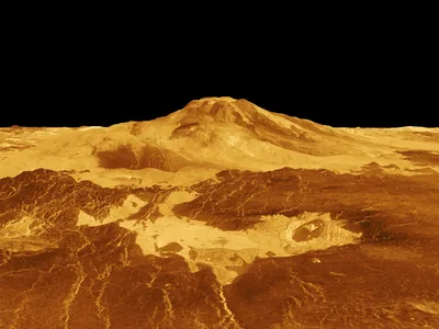
PIA00106.jpg — NASA / JPL, Public Domain (NASA).
Maat Mons in a computer-generated three-dimensional perspective of the Venusian surface, released by NASA from Magellan radar data on 22 April 1992. The vertical scale is exaggerated; the colour is a conventional treatment, not a snapshot in visible light. NASA / JPL. Public domain. Photojournal PIA00106. Computer-generated perspective from Magellan radar. May be used in paid printables (public domain).
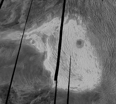
PIA00149.jpg — NASA / JPL, Public Domain (NASA).
Maxwell Montes and Cleopatra Crater, in a full-resolution Magellan radar image centred at 65° north, 6° east. NASA’s caption gives Maxwell as the highest mountain on Venus, rising almost 11 kilometres (6.8 miles) above the mean planetary radius. NASA / JPL. Public domain. Photojournal PIA00149. May be used in paid printables (public domain).
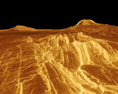
PIA00200.jpg — NASA / JPL, Public Domain (NASA).
A false-colour, computer-generated three-dimensional view of Sif Mons and Gula Mons in western Eistla Regio, released from Magellan data on 22 April 1992. The colour and vertical scale are a visualisation, not a visible-light photograph. NASA / JPL. Public domain. Photojournal PIA00200. False-colour computer-generated perspective. May be used in paid printables (public domain).
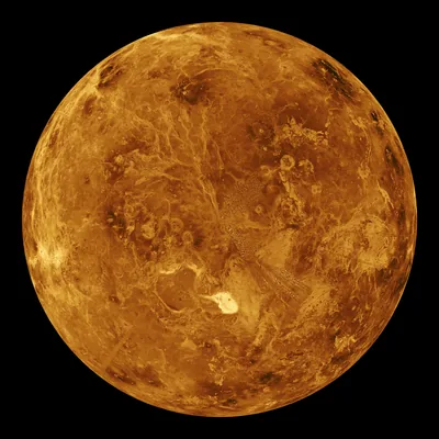
PIA00271.jpg — NASA / JPL, Public Domain (NASA).
A computer-simulated global view of the northern hemisphere of Venus, assembled from Magellan radar mapping. The colour is a conventional treatment of radar brightness, not a photograph in ordinary light. NASA / JPL. Public domain. Photojournal PIA00271. Computer-simulated global view. May be used in paid printables (public domain).
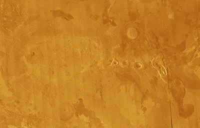
PIA00265.jpg — NASA / JPL, Public Domain (NASA).
A full-resolution Magellan mosaic of volcanic plains on Venus, in false colour, showing a concentrated field of volcanic features. This is a radar mosaic, not an aerial photograph. NASA / JPL. Public domain. Photojournal PIA00265. False-colour radar mosaic. May be used in paid printables (public domain).
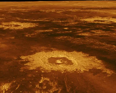
PIA00103.jpg — NASA / JPL, Public Domain (NASA).
Three impact craters in a computer-generated three-dimensional perspective of northwestern Lavinia Planitia, from Magellan radar data. The vertical scale is exaggerated. NASA / JPL. Public domain. Photojournal PIA00103. Computer-generated perspective. May be used in paid printables (public domain).
The surface-conditions desk is our own arrangement of sourced NASA figures, not a new measurement. The site is part of the ReallyByte network.